In Pontcysyllte Aqueduct, the Canal and the surrounding landscape, we are very lucky to have a well-preserved historic environment. There are places to visit in the area today that would still look familiar to Telford, Jessop and the other engineers. We also have hundreds of smaller, connected historic objects in museums and heritage collections. But sometimes we rely on documents to reveal a little more of the history, to show us something that is missing, or to gather the available information together.
Old business papers, newspapers, letters and records can reveal hidden histories and forgotten facts. They can show us that things don’t look the same as they always have, or perhaps they don’t look like they were supposed to. They can shed light on opinions and attitudes from the past which are different today.
Modern documents can give us new perspectives and new ways to look at how buildings were built, why events happened, and how people lived their lives. They help us to record preserve and celebrate historical monuments for the future.
History is not fixed at one time but always added to, re-examined and re-interpreted. This very website is another document among many, charting the canal, its history, landscape and people.
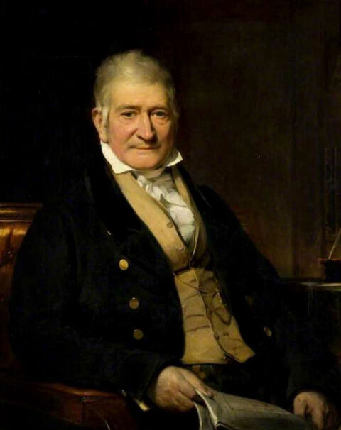
A late portrait of Thomas Telford, painted by George Patten in 1829, shows him holding a set of engineering plans. They may be for an aqueduct, although not the one at Pontcysyllte. The portrait is showing the viewer how such documents, the designs for structures, are essential to the engineer’s work.
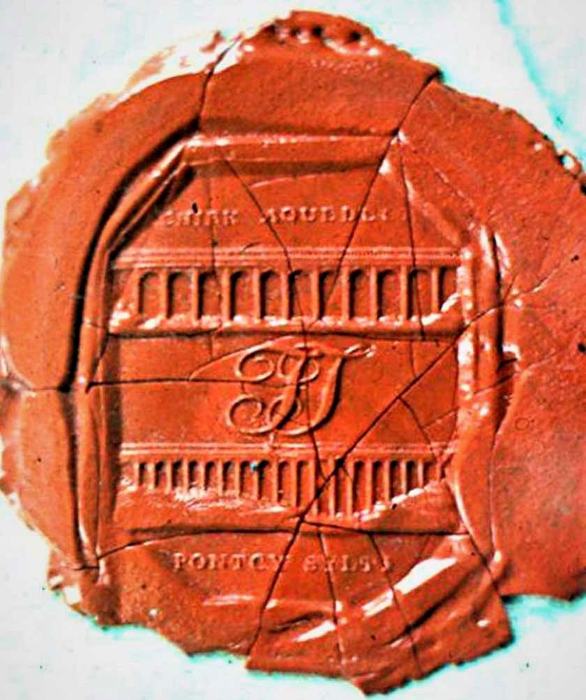
This wax seal, on a letter to another Scottish engineer, James Jardine, shows Telford’s lifelong pride in his aqueducts at Chirk and Pontcysyllte. The letter was written in 1828, more than two decades after the aqueducts were finished, and after Telford had created many other impressive monuments during his career.
Telford’s seal: Courtesy Prof. Roland Paxton, ICE Scotland Museum, Heriot-Watt University
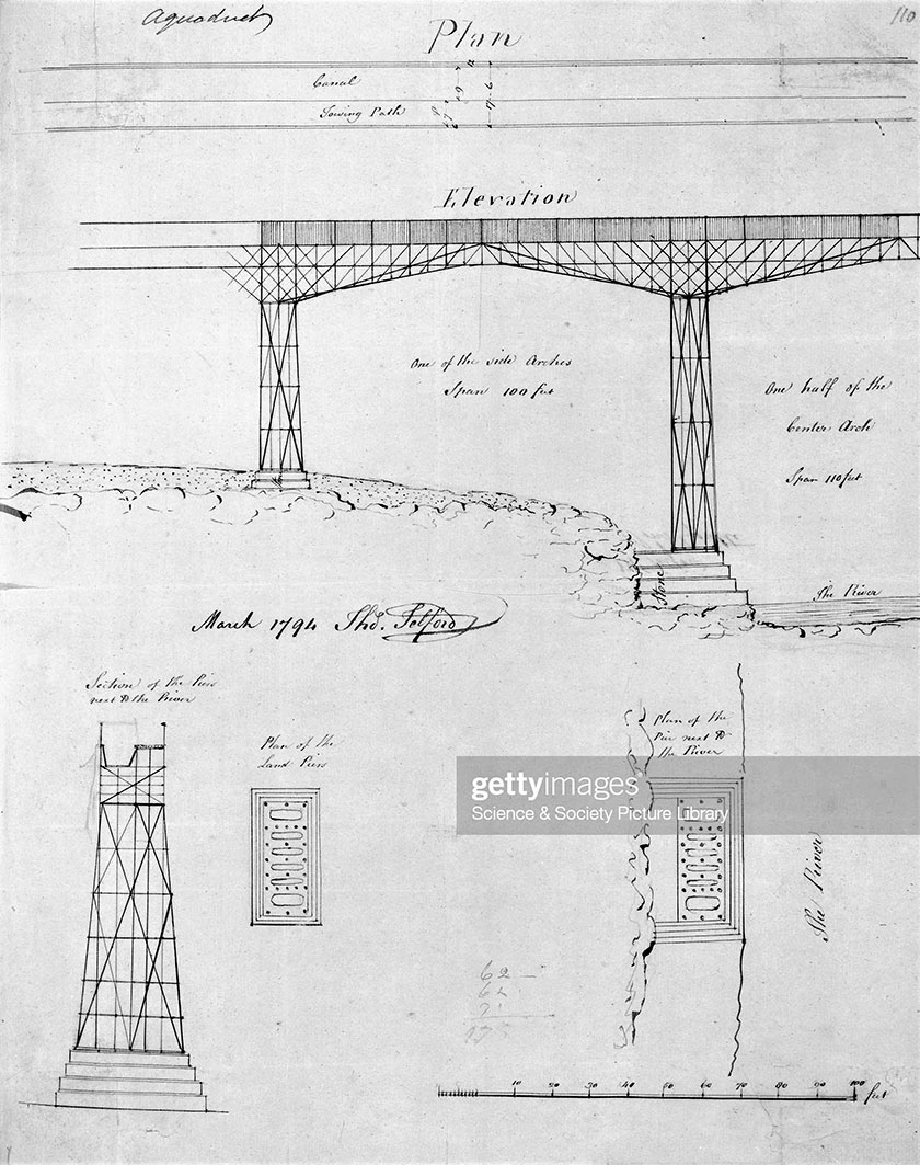
A drawing by Telford, later dated by him as from 1794, shows a concept for an aqueduct with the piers and the supports for the trough constructed using iron latticework. This may have been an early idea for the design of Pontcysyllte Aqueduct, providing an insight into the evolution of the finished product.
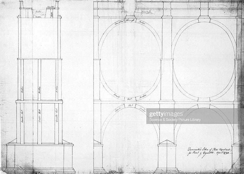
Telford’s early design was not the only one for Pontcysyllte Aqueduct. In 1794, John Duncombe, who surveyed the route for the canal, drew this concept for a traditional, masonry aqueduct to cross the River Dee. Would this unusual double-arch structure have been considered as beautiful as today’s aqueduct, had it been built?
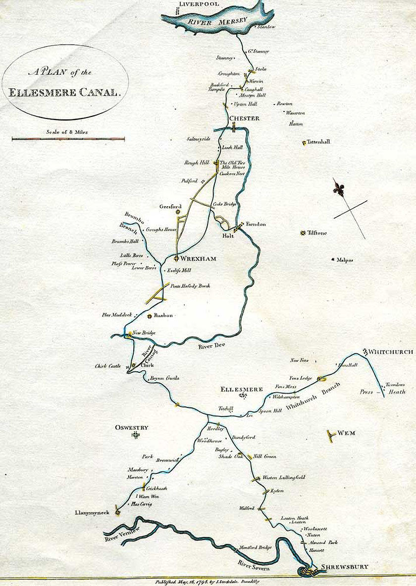
John Duncombe’s 1795 map shows the canal route as it was planned that year. It is an important reminder of the original plan to link the major rivers of the Mersey, the Dee and the Severn. The part between Trevor and Chester was never built, so the map was soon outdated.
Duncombe map (cc-by-sa/2.0)
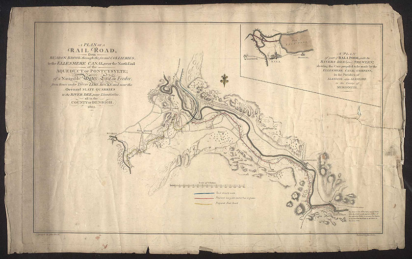
An 1803 map shows the ‘feeder’ branch of the canal, from Trevor Basin to the Horseshoe Falls at Llantysilio. Although the railway only occupies a small part of the map, the document title – A Plan of a Railroad from Ruabon Brook – hints at how rail would come to supersede the canal’s importance.
Llangollen branch map: By permission of The National Library of Wales
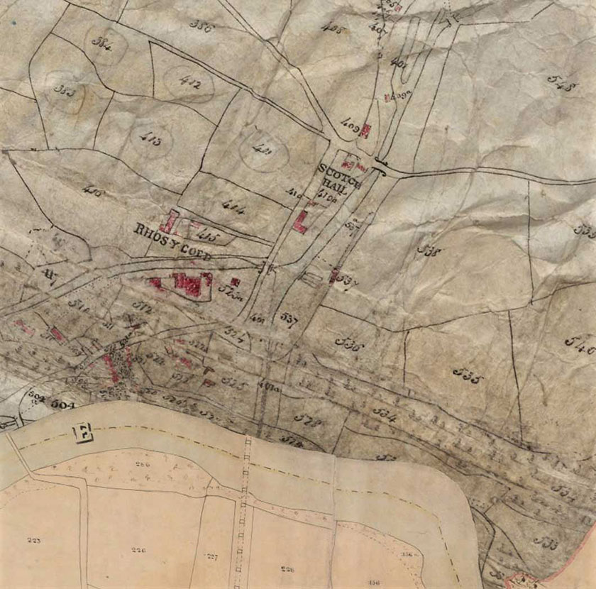
Tithe maps were produced in Wales and England after the 1837 Tithe Commutation Act. Tithes were taxes paid to the local church by landowners. Every field and garden was numbered for assessment but the canal only paid tithes on buildings, so it is not shown in much detail. The aqueduct isn’t even labelled.
Tithe map: By permission of The National Library of Wales
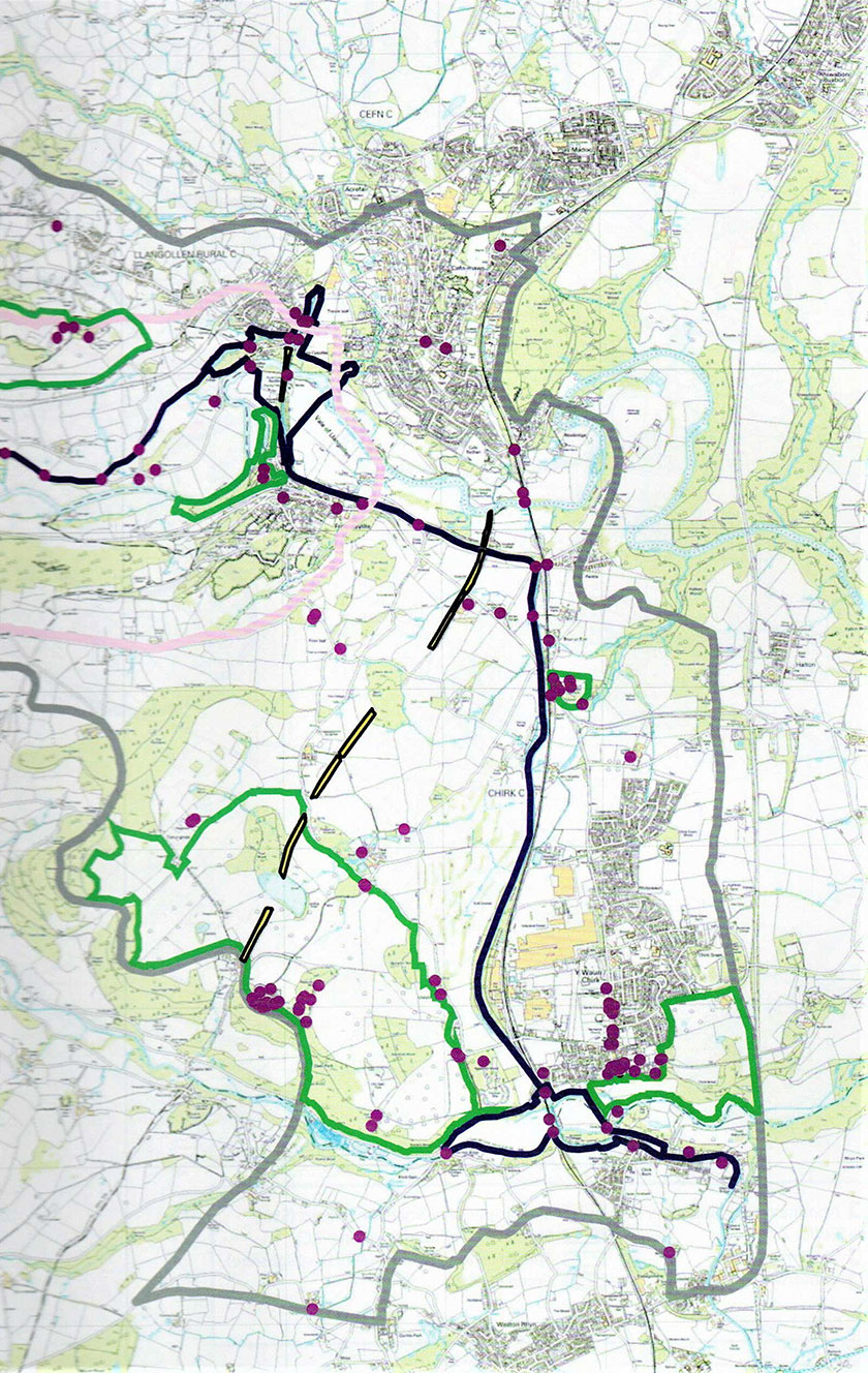
Modern maps were surveyed for the World Heritage Site nomination. The line of the canal and around the aqueducts is blue. Purple dots are listed buildings, historic landscapes are green or pink, and Offa’s Dyke ancient monument is yellow. The rich history of the area is apparent in this document.
The boom in canal building at the end of the Eighteenth Century led to a rush of people investing in new projects. This became known as ‘Canal Mania’. Cartoons such as this one show how some people viewed the investors, eagerly taking up the canal companies’ proposals.
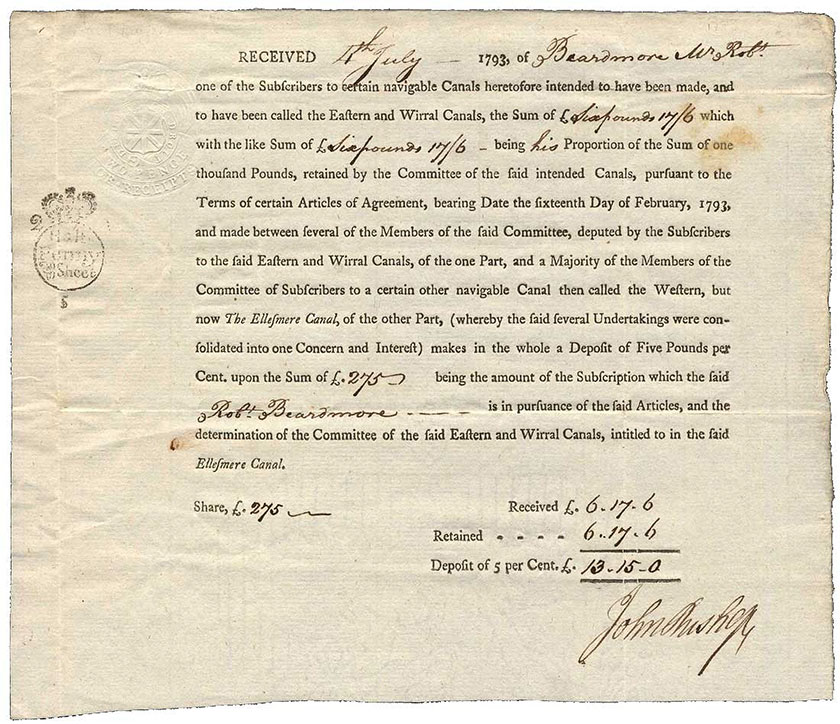
Canal companies sold shares to investors to finance the building work. This 1793 receipt shows that Robert Beardmore promised to invest £275 (more than five years’ wages for a skilled worker) in the Eastern and Mersey Canal. This later merged with the Ellesmere Canal when a link from Chester Canal to Whitchurch was promised.
Share certificate: Reproduced by kind permission of Spink and Son Ltd
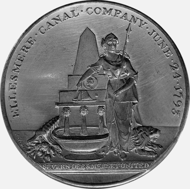
A company’s official seal was used to authenticate documents. The designs were a form of corporate branding. The Ellesmere Canal Company seal showed a horn of plenty, symbol of prosperity, next to a basin in which an aqueduct stands, complete with boat. The goddess Britannia represents the unity of the three rivers.
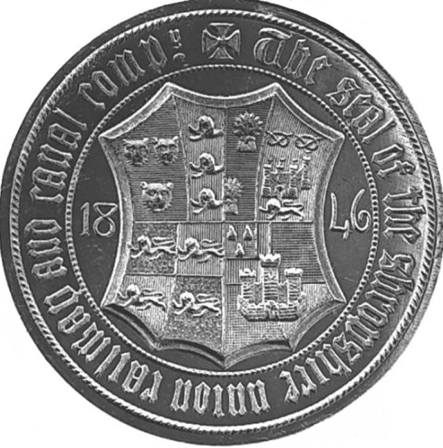
The Shropshire Union Railways and Canal Company was formed in 1846 and took over the running of the Ellesmere Canal, now the Llangollen Canal, from that year. Its seal is very different from the Ellesmere Canal Company’s, showing a coat of arms made up from the crests of towns along its routes.
SUC Seal: bw 192.3.1.36.7.8 Supplied by Canal & River Trust
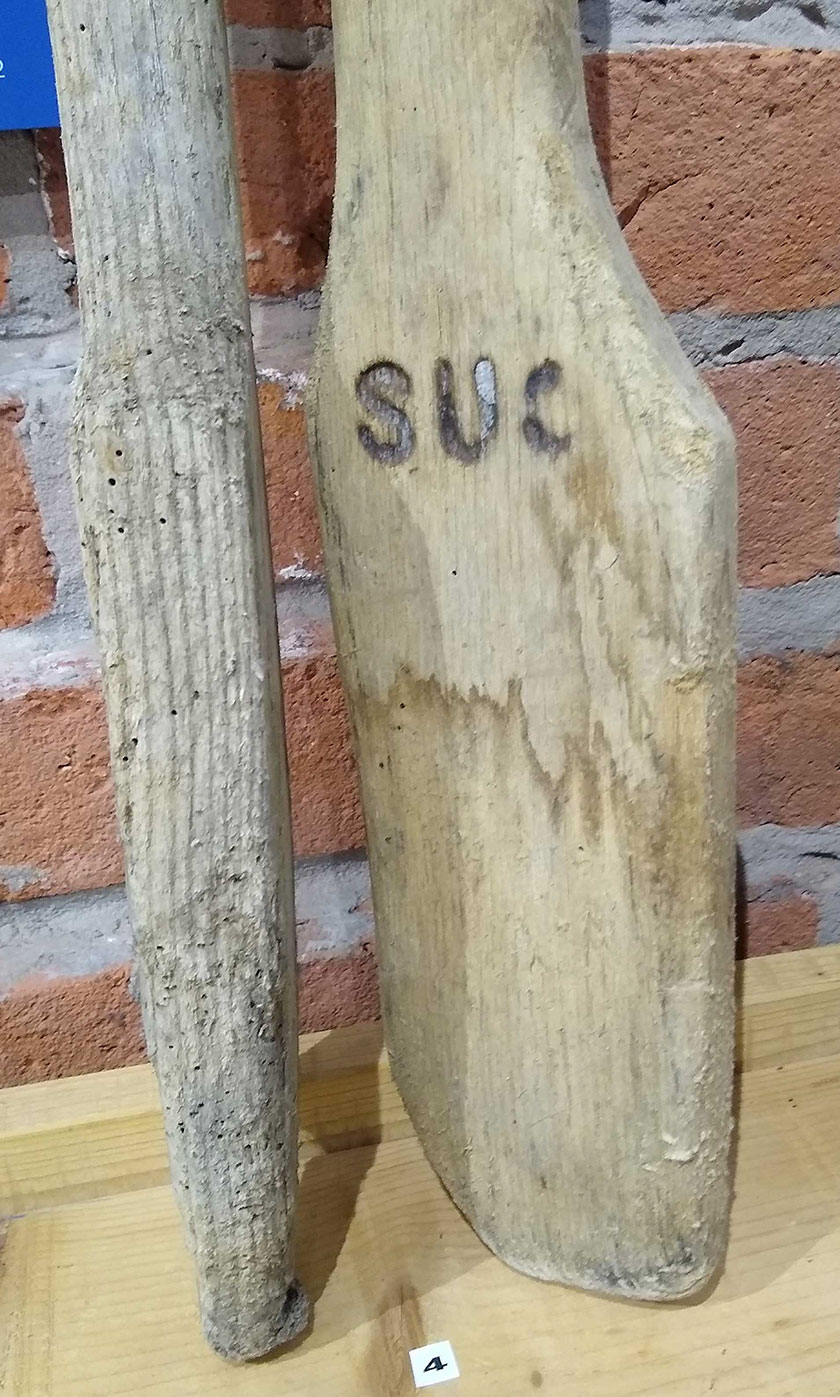
The Shropshire Union Railways and Canal Company made sure that all of its property was documented and carried the company mark. The initials S.U.C., or sometimes S.U.Co., were seen on everything from canal boats to signs and even on small items such as tools, like this paddle for working clay in the canal bed.
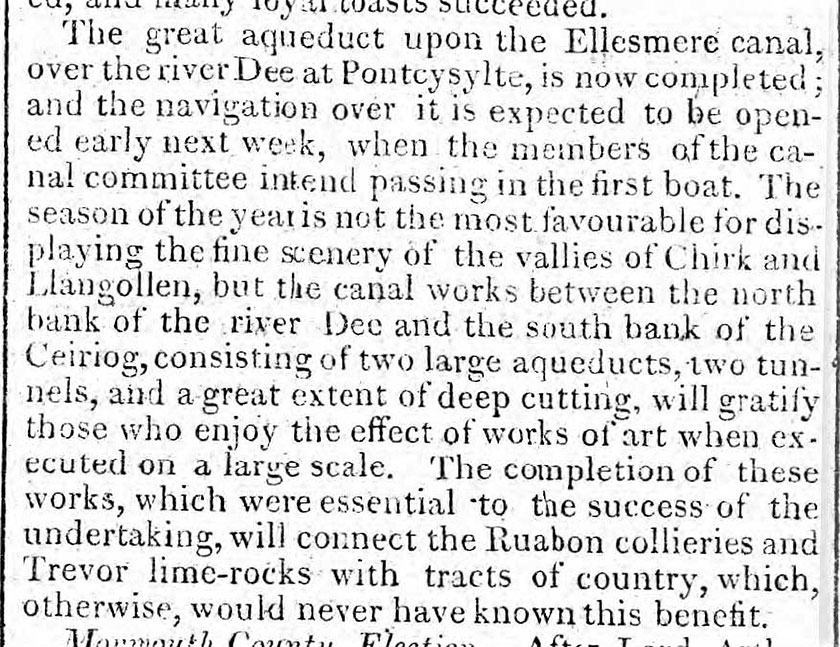
Nationwide interest in Pontcysyllte Aqueduct is shown in early newspaper reports. The first newspaper in Wales, The Cambrian, was published in Swansea from January 1804. In July that year it reported on the construction of the canal. On 23rd November 1805, the paper noted the completion of the aqueduct.
Newspaper report: By permission of The National Library of Wales
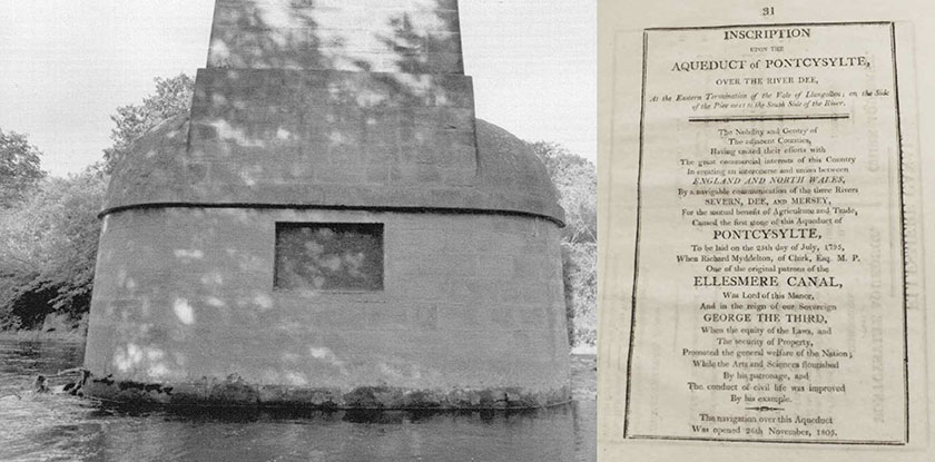
At the opening of Pontcysyllte Aqueduct on 26th November 1805, a dedication was read to the crowd. The text was later reproduced in a shareholders’ report. It is also written on a bronze tablet at the base of one of the piers standing in the river, where it is almost impossible to read.
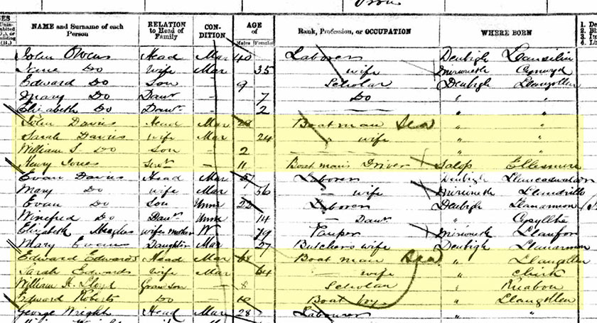
Documents about the canal do not only concern the rich and famous people involved with it. Details in newspaper articles, travel books and official papers tell us about the lives of many of working people too. On this page from the 1871 census, you can see two boating families living in Froncysyllte.
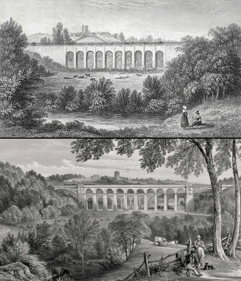
Artists’ impressions of the canal can provide valuable evidence for its history. These engravings show Chirk Aqueduct viewed from more or less the same position but with a significant change in the landscape. The first was printed around 1820. The second dates from soon after the railway viaduct had opened in 1848.
Chirk Aqueduct: By permission of The National Library of Wales
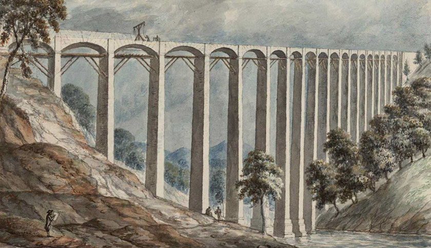
As well as documenting changes in landscapes, artists can sometimes show how the changes were brought about. John Ingleby’s watercolour of the early 1800s clearly shows the wooden scaffolding for Pontcysyllte Aqueduct, as well as the simple crane used to swing the ironwork into place on the narrow platform.
Ingleby view of Pontcysyllte: By permission of The National Library of Wales
Modern technology has created new forms of document for the canal. Digital reconstructions and deconstructions of buildings and structures allow us to analyse how they were put together. This gives us a new appreciation of the skill of the engineers and assists with conserving their work in a sympathetic way.
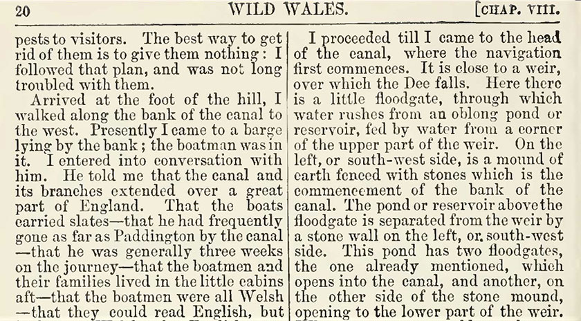
Many writers have left us with wonderful descriptions of the canal, the aqueducts and the landscape. George Borrow stayed in Llangollen in 1854 and spent some of his time walking the canal towpath. His recollections, published as Wild Wales in 1888, tell us about some of the people and places he saw.
Excerpt from George Borrow
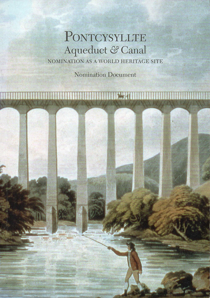
Before Pontcysyllte Aqueduct and eleven miles of the Llangollen Canal were proposed as a World Heritage Site, many documents had to be researched, gathered and summarised. The 232-page Nomination Document is backed up by more than ninety national and local government acts and policies, historic surveys, studies and management plans.
Nomination document: Courtesy of Wrexham County Borough Council and RCAHMW
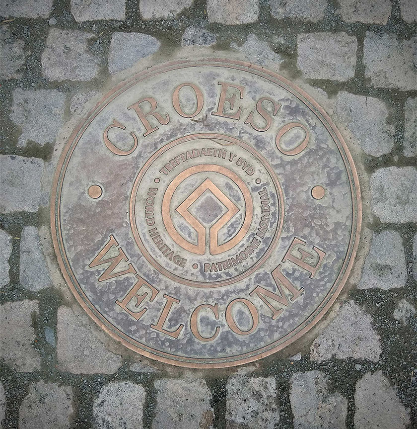
Since 2009, a bronze marker set into the towpath at Gledrid bridge shows where the Llangollen Canal becomes a UNESCO World Heritage Site. The central square of the design symbolises the results of human skill and inspiration, the circle celebrates the gifts of nature. The languages and round border represent the world.