Introduction
The magnificent Pontcysyllte Aqueduct over the Dee Valley was the first great masterpiece of Thomas Telford, made possible by the innovative technology of the local iron industry at the time. Chirk Aqueduct was the tallest navigable aqueduct in the world when it opened in 1801 while Chirk Tunnel was one of the first British canal tunnels to be built with a towpath.
Scenic rock cuttings, dramatic embankments and tree-lined cuttings ensure the views are constantly changing. There is plenty to admire along the way with beautiful bridges, charming cottages and lots of detail such as the rope marks under the bridges, worn by the ropes of hundreds of boats over the years.
Llangollen was the first canal to offer pleasure boat trips which are still running today and just as popular! However you choose to explore we hope you enjoy your tour!
How Pontcysyllte became a WHS
Click on any Point of Interest marker to view the description
1. Llantysilio – Where Llangollen Canal Begins
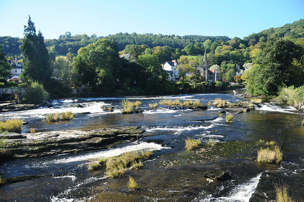
Situated in the heart of the beautiful Dee Valley, Horseshoe Falls is the essence of the picturesque landscape that has inspired writers, artists and musicians for centuries. Here water is drawn from the Dee to feed the Llangollen Canal via a weir designed by Telford to complement and enhance the landscape.
This was a popular beauty spot before the weir was constructed and early tourists agreed that this area was the most beautiful part of North Wales. Local landscape artist Edward Pugh described it as ‘great and fine, even passing description’ in his book published in 1816. Edward had painted ‘A fall on the Dee’ in 1794, over 10 years before Horseshoe Falls was constructed to draw a steady supply of water from the Dee.
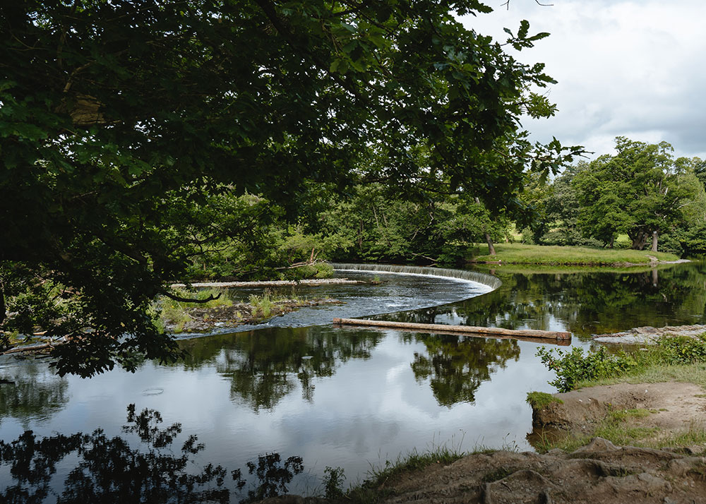
Horseshoe Falls
Horseshoe Falls is a J shaped weir, just over 1 metre high and 140m long. It was built in stone with the innovative use of cast iron edging added later following a partial collapse of the weir during flooding in the winter of 1820/21.
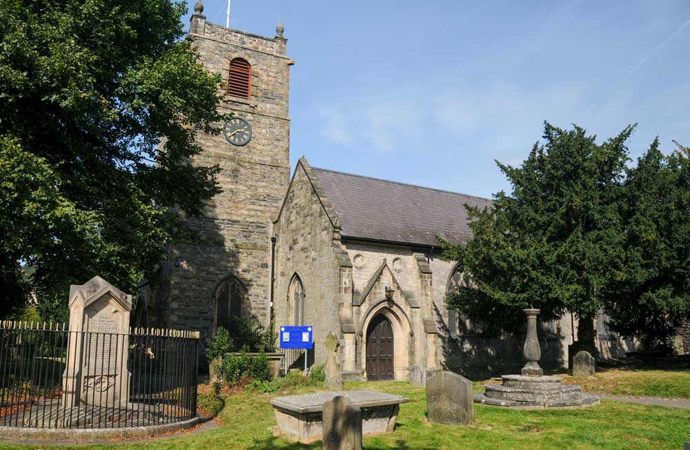
St Tysilio’s Church may date back to 1180 but much of the current building dates from the 1400s. It is one of several churches in Wales named after Tysilio, a 7th century saint who came from Powys.
Chain Bridge, built by Exuperius Pickering in 1817, was supported by six oak pillars and strengthened by twelve wrought iron chains. The design may have influenced projects which Telford was working on, in particular Conwy and Menai suspension bridges which he completed just nine years later.
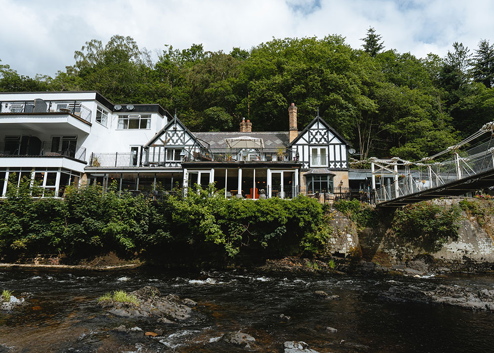
Chain Bridge Hotel was originally built for Pickering’s workers but as the bridge became popular with tourists it was replaced with the more attractive building, constructed when Berwyn Railway Station opened. Visitors could now easily get here on the railway and take advantage of new tourist attractions such the horse drawn boat trips along the canal.
Pentrefelin Slab and Slate Works were built in the 1840s to process slate from the quarries near the Horseshoe Pass. The slate was split into flagstones, paving, tombstones and even billiard and operating tables.
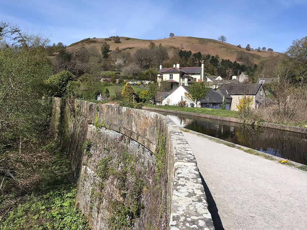
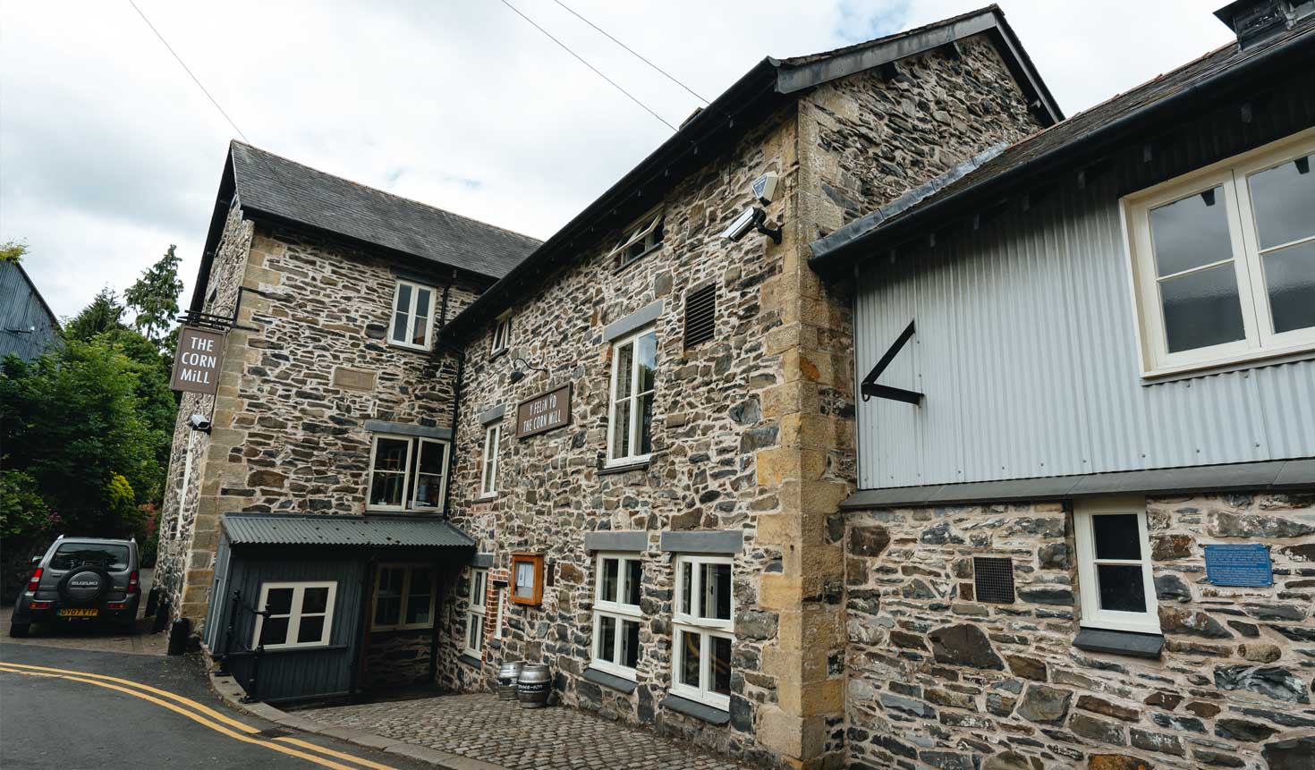
Eglwyseg Aqueduct has one large arch over the River Eglwyseg and a second one for the watercourse carrying the water from Pentre Mill, the former corn mill for Valle Crucis Abbey. It is built using traditional materials of stonework and puddled clay to make a watertight lining.
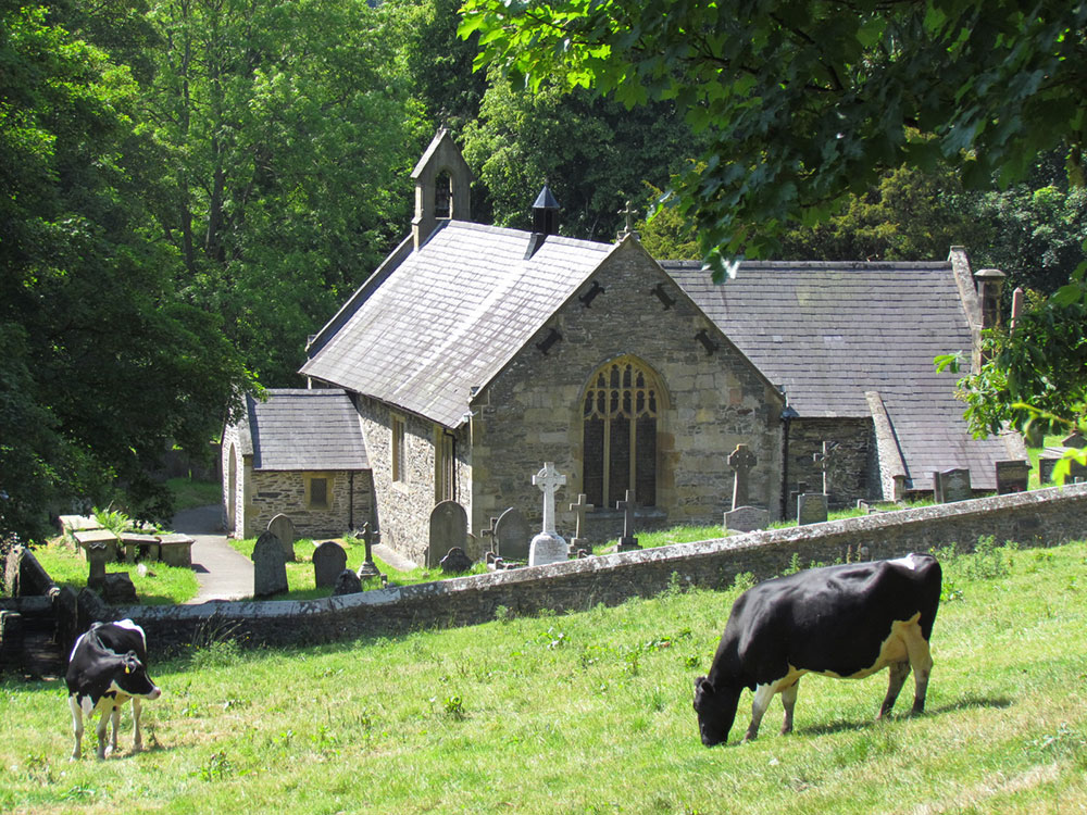
St Tysilio’s Church © Heather Williams
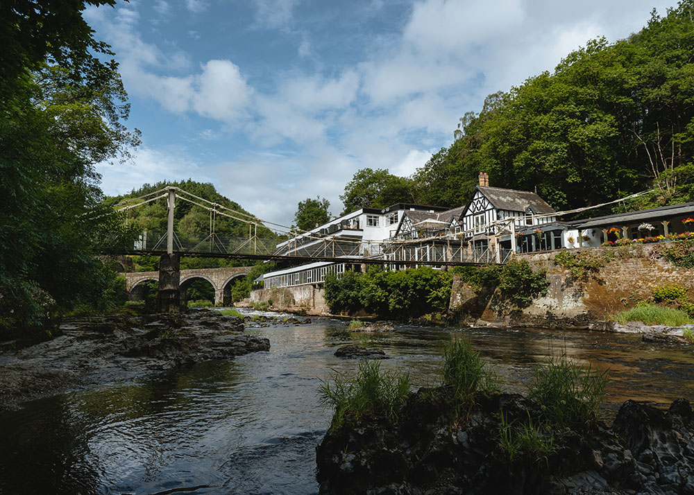
Chain Bridge
Chain Bridge Hotel
Eglwyseg Aqueduct © Jo Danson
2. Llangollen – Where Wales Welcomes the World
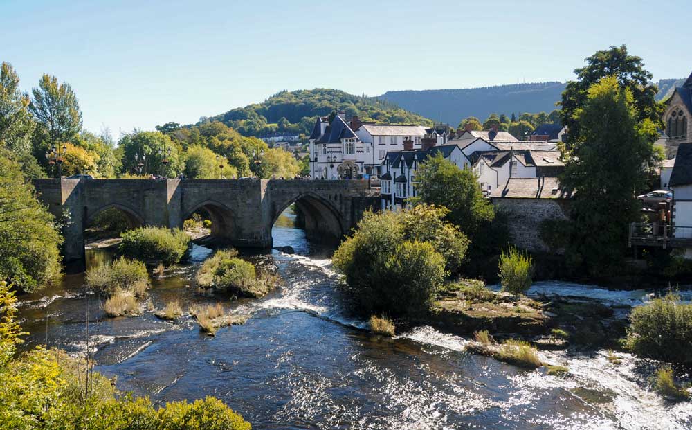
Visitors have been drawn to Llangollen, nestled in the picturesque Dee Valley, for many years, admiring the views and enjoying walks along the river and canal side. Artists and writers continue to be inspired by the stunning landscape full of natural and historic features.
Llangollen developed around the bridge over the River Dee from the 1300s onwards. Abundant water from the River Dee powered corn mills and later fulling mills as the town grew and prospered. Llangollen Canal boosted trade, bringing in coal to fire the limekilns in the Valley and providing cheaper, more reliable transport for slate and limestone quarried from the hills above.
© Jo Danson
Llangollen takes its name from the church founded by Saint Collen around 600AD. Collen was a champion of Christianity and is said to have come here after murdering a local man-eating giantess who guarded the nearby Horseshoe Pass. A well at the top of the Pass is believed to be the natural spring where Collen washed his bloody hands and sword.
Plas Newydd was the home of the ‘Ladies of Llangollen’ in the late 1700s. Lady Eleanor Butler and Sarah Ponsonby had run away from Ireland and settled here, describing Llangollen as ‘the most beautifullest country in the world’.
Llangollen International Musical Eisteddfod started as a peace initiative to bring war weary countries of Europe together in the beautiful Dee Valley. The first Eisteddfod was held in July 1947, attended by 40 overseas groups representing 14 different countries.
© Jo Danson
St Collen’s Church © Jo Danson
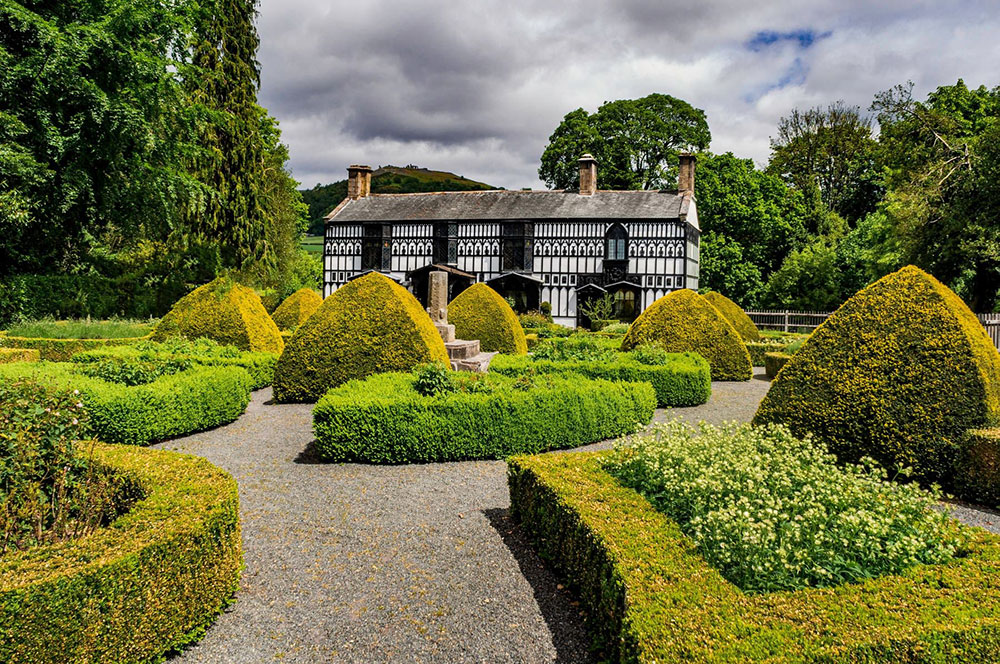
Plas Newydd © Denbighshire County Council
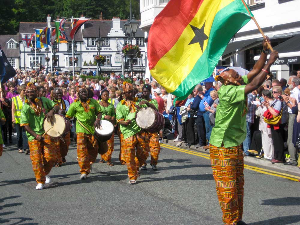
Llangollen International Musical Eisteddfod © Heather Williams
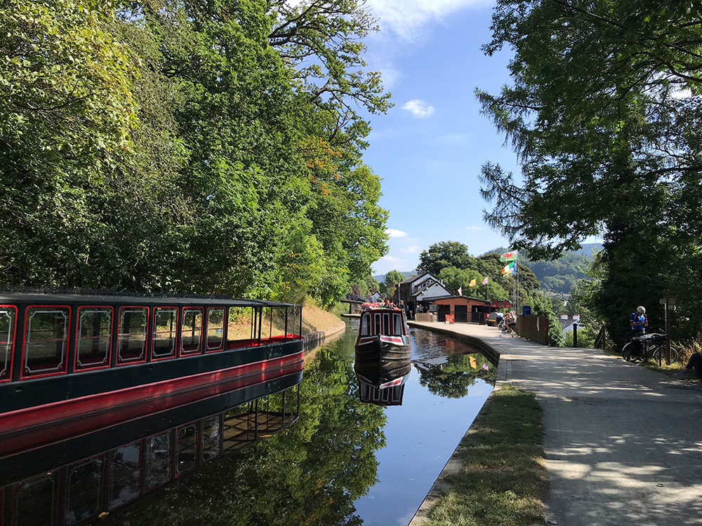
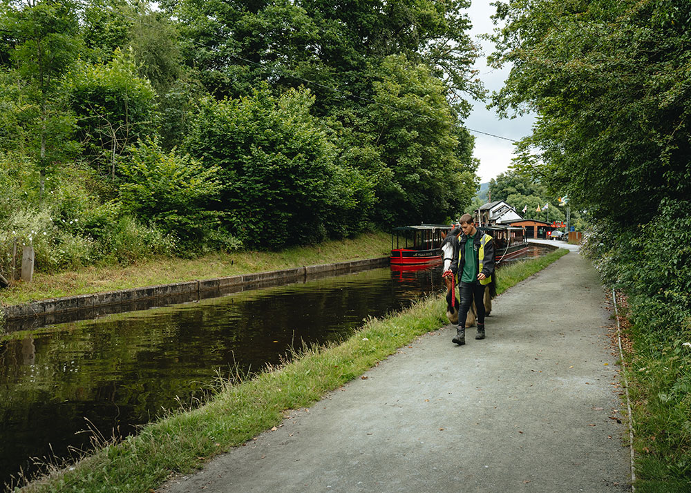
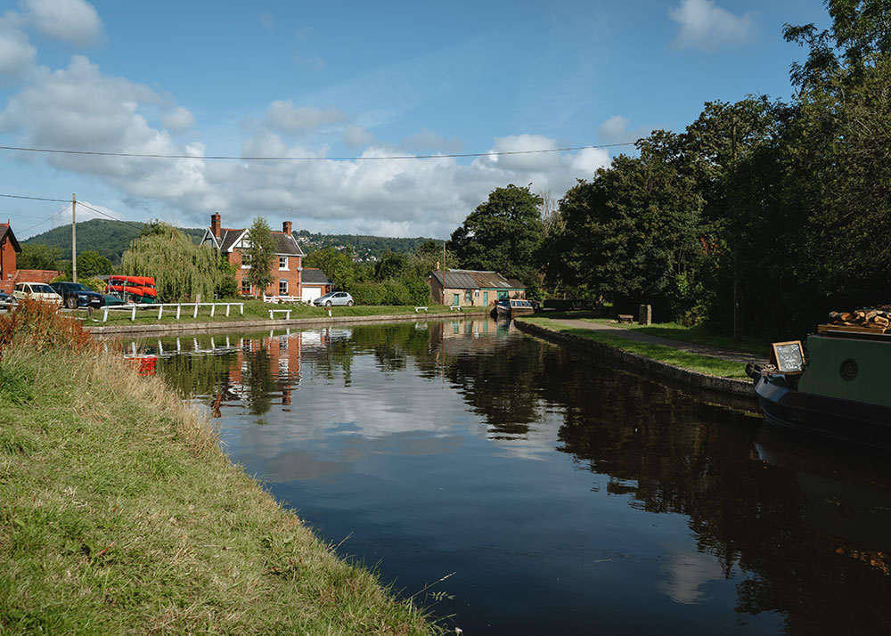
3. Llangollen Wharf – From Trade to Tourism
Llangollen Wharf is one of the most popular spots on the Llangollen Canal. Here horses pull boats full of excited tourists along the canal, just as they have done for nearly 150 years. Along the canal towards Trevor there are fabulous views up to Castell Dinas Brân and Trevor Rocks, extensively quarried over the years.
Llangollen was already an important market town when the canal arrived. Both the town and local industry benefitted as essential supplies such as coal arrived by barge while slate, lime and other goods could be exported much more easily and cheaply.
© Jo Danson
When Mr Newbery of the Royal Hotel ran a pleasure boat service from Llangollen Wharf to Chain Bridge in 1881 it was probably the first pleasure boat service on a canal in Britain. In 1884 Llangollen born Captain Samuel Jones bought a redundant boat ‘The Pioneer’ and set up a business running daily trips to Chain Bridge and Horseshoe Falls.
Captain Jones described the route to Horseshoe Falls as ‘a route of unsurpassed natural grandeur’ and by 1890 he had increased his fleet to six pleasure boats, the largest of which would hold 200 passengers, to keep up with growing demand.
Unusually for a canal the flow of water in the Llangollen Canal was enough to power Upper Dee Flannel Mill. Along the canal is the Sun Inn, so called because it sold beer from the Sun Brewery, the longest running brewery in Llangollen. Just below the Sun Inn was a wharf on the canal where limestone was brought down from Trevor Quarry by a tramroad and incline.
Bryn Howel is a striking house built in 1896 for James Coster Edwards, the son of J. C. Edwards Senior, owner of the great brick, tile and terracotta works. The house was turned into a hotel in the 1960s. Guests include Pavarotti who stayed here on a visit to the Llangollen International Eisteddfod in 1995.
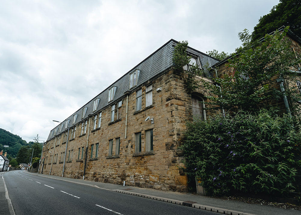
Upper Dee Mills
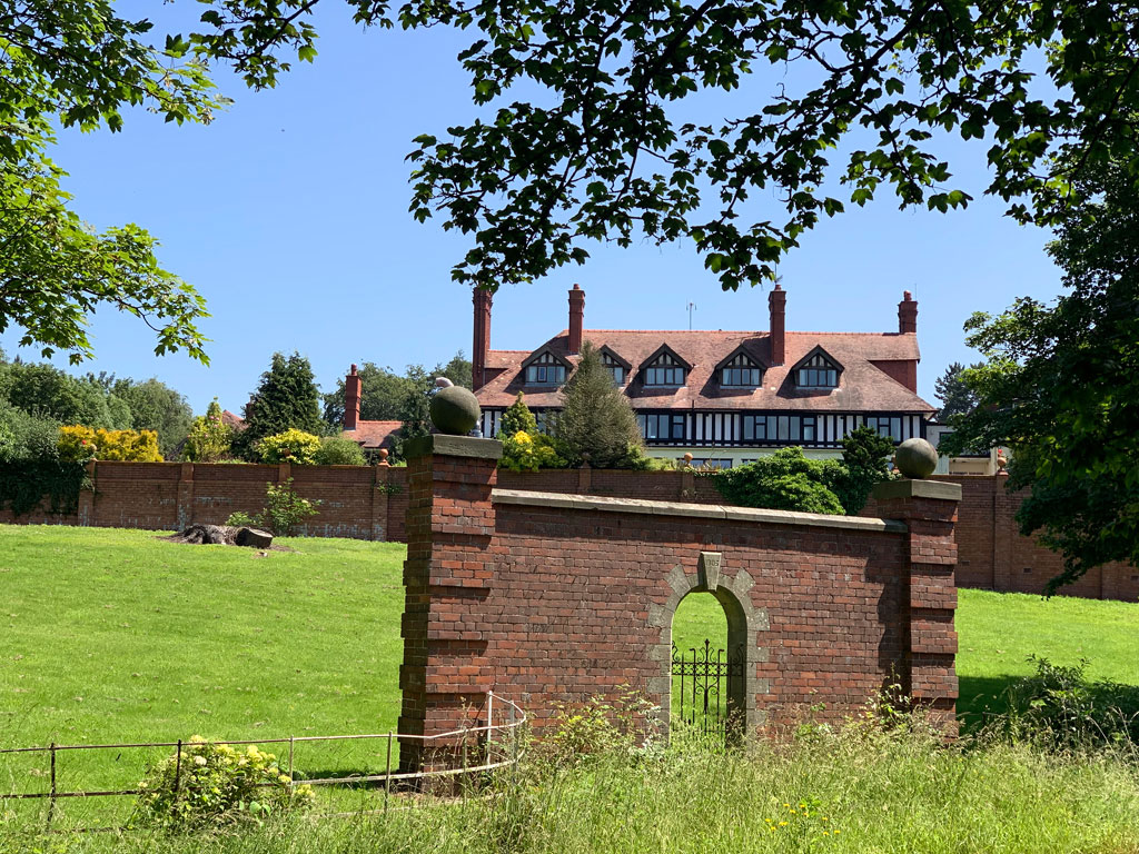
Bryn Howel © John Allan
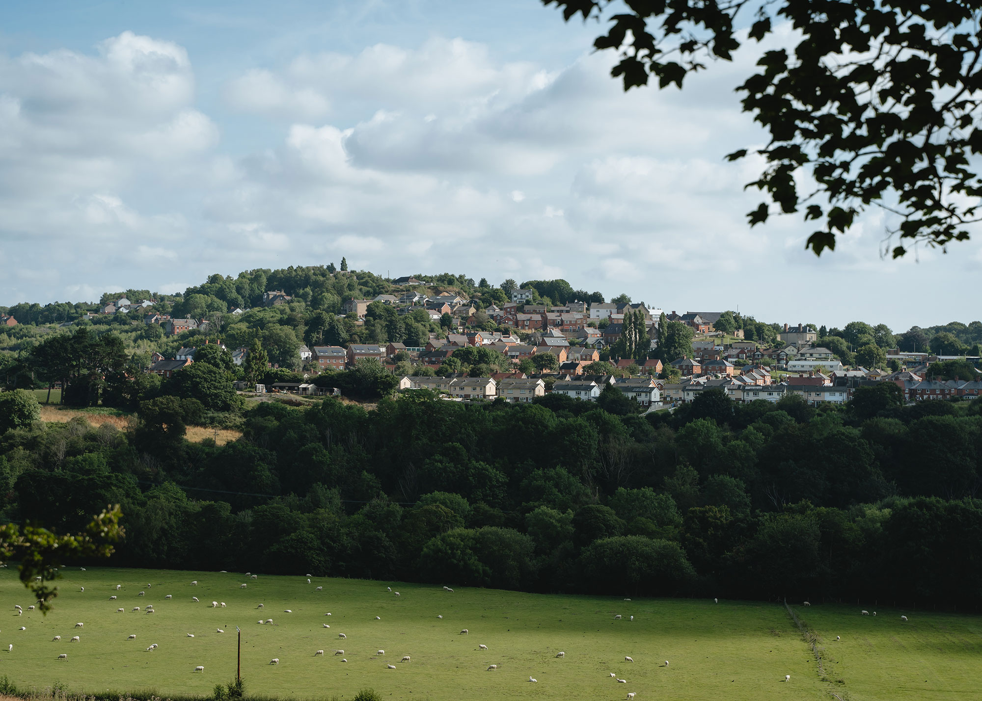
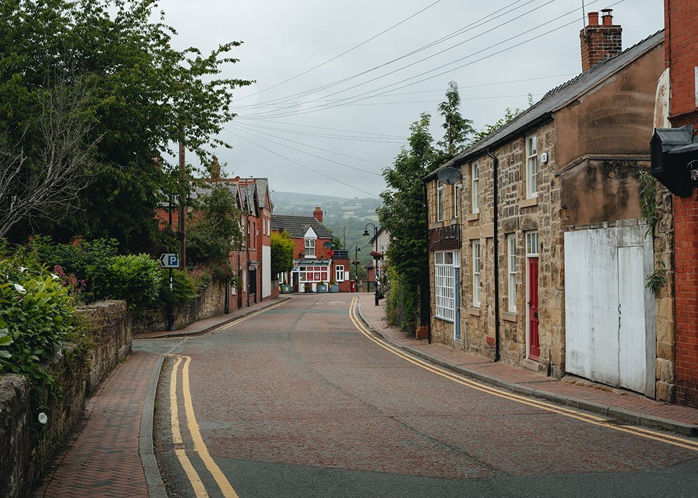
4. Cefn Mawr – A Village Shaped by Natural Resources
The rich natural resources around Cefn Mawr including high quality sandstone, rich coal seams with associated clay deposits and ironstone have been exploited since medieval times. As industry developed the town grew to furnish the needs of the growing population.
The Llangollen Canal brought new opportunities and increased access to markets. Iron was worked at several furnaces and forges while coal was mined in pits at Cefn, Plas Kynaston and Dolydd.
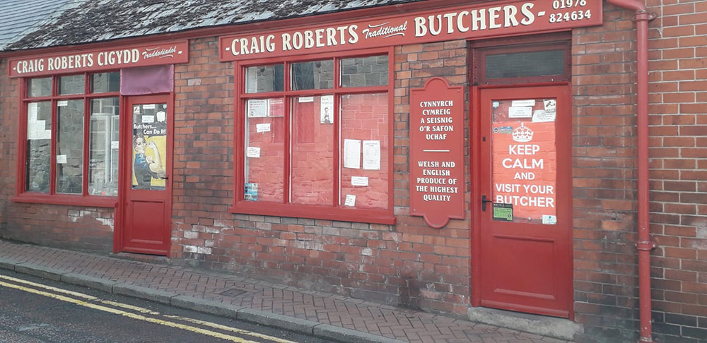
Retail businesses flourished as people from surrounding villages came to buy food, clothing and hardware such as J. Thomas Tinsmith who supplied water and ‘snappin’ tins for the colliers. Growing numbers of chapels and pubs served the spiritual and social needs of the village.
Graesser’s chemical works was established to extract paraffin oil and wax from the local shale and went on to become the world’s leading producer of phenol.
Cefn Mawr Museum, at the back of George Edwards Hall, opened in 2014 and is run by enthusiastic volunteers. It celebrates the history and people in Cefn Mawr and the surrounding communities and is packed with objects, photographs and documents that have been loaned or donated by local people. Two popular objects are a coracle that was used for fishing for salmon on the river and an original nut and bolt from Pontcysyllte Aqueduct.
The Museum is open Monday, Wednesday and Friday mornings. Find out more about the Museum here.
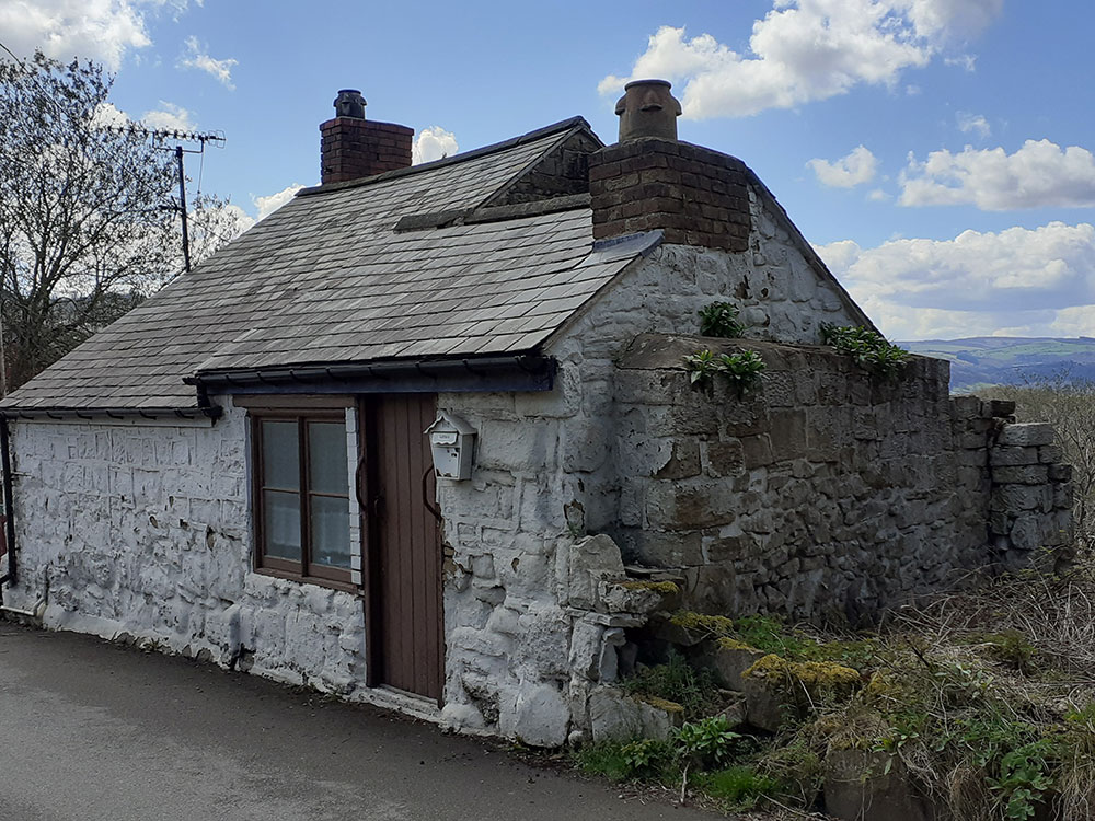
The Cefn y Fedw sandstone quarries have been quarried since medieval times. The stone is a pale yellow when it is first cut but it weathers to a rich golden colour after a few years. Cefn Stone is hard-wearing but can be cut precisely to make a perfect fit between every block.
It was used for local churches, such as St Giles in Wrexham, famous buildings such as the Walker Art Gallery in Liverpool and was also an ideal stone for the construction of Pontcysyllte Aqueduct.
© Heather Williams
© Heather Williams
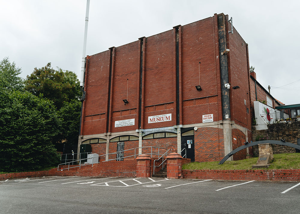
Cefn Mawr and District Museum
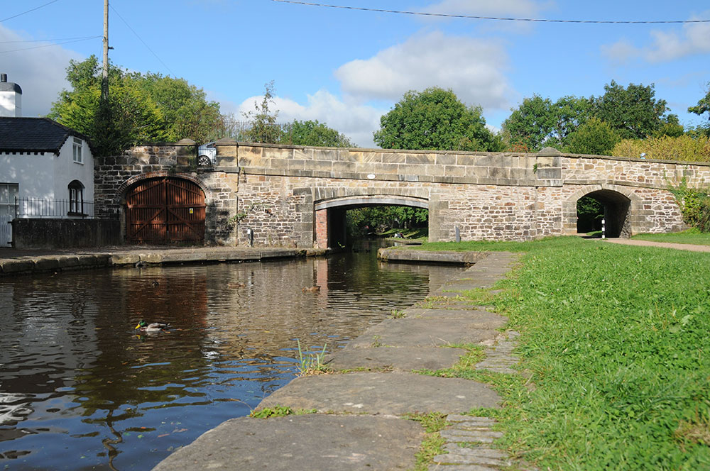
5. Pontcysyllte – The Stream in the Sky
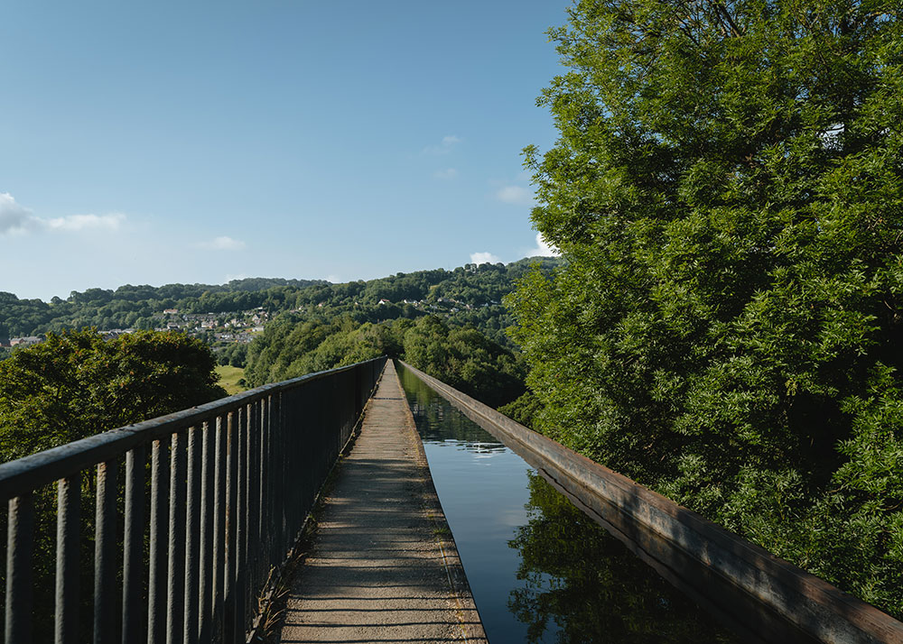
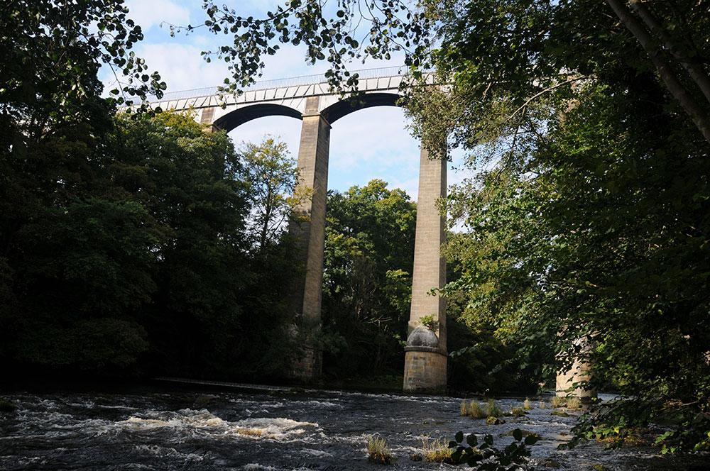
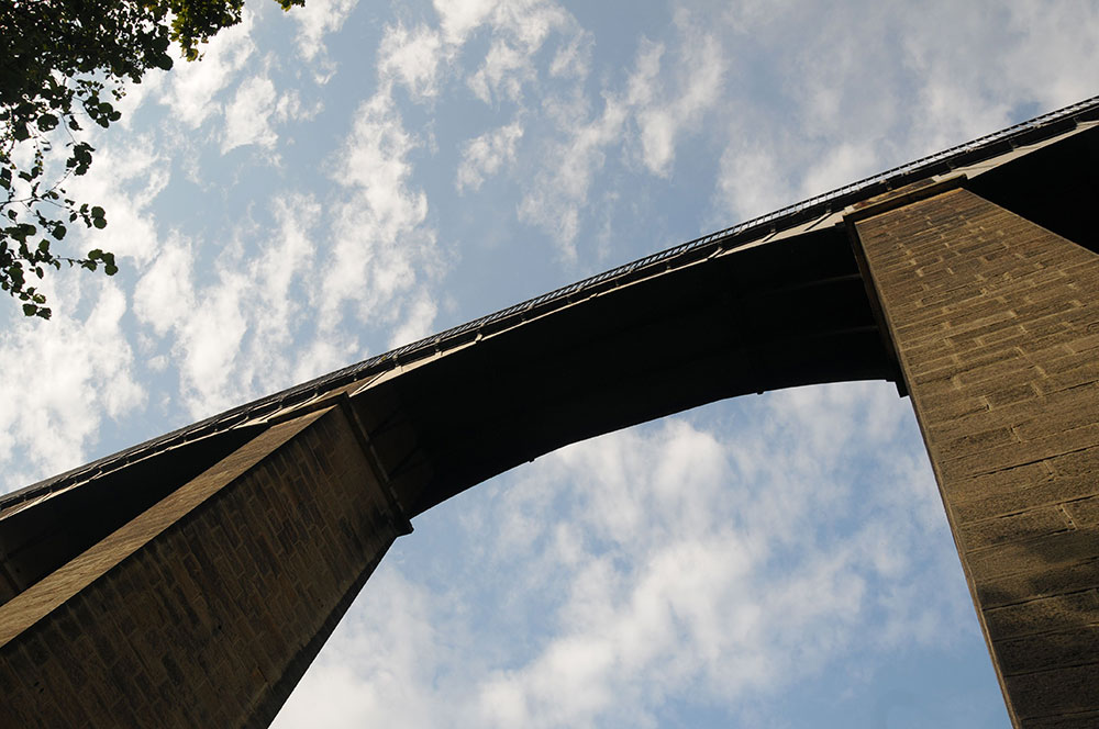
Pontcysyllte Aqueduct is the jewel in the crown of the World Heritage Site. It was the tallest, navigable aqueduct in the world for over 200 years after it opened in 1805 and was built using innovative technology. Crossing the aqueduct is just as exciting today as it was when it first opened.
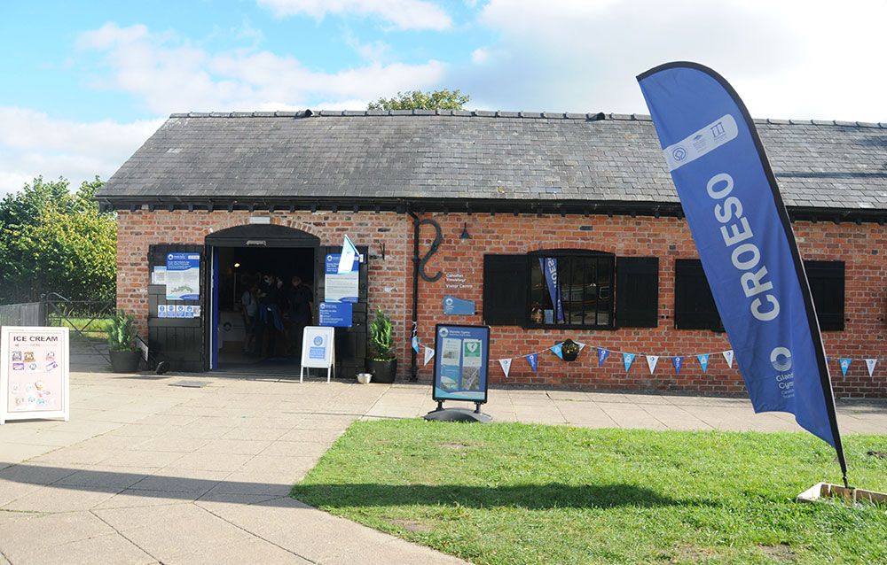
Then Trevor Basin would have been a hive of activity with boats being made or repaired and tonnes of coal and other goods being transferred between barges and trams. Today it is a hub for visitors and locals alike and during the summer months it is always busy with canal boats mooring or turning to go along the Llangollen Canal and people choosing to walk, paddle their canoes or push their bikes over the aqueduct.
The dry docks are still used as they were 200 years ago but warehouses and other buildings have found new uses as pubs, cafes and a visitor centre.
William Jessop and Thomas Telford developed the design for an aqueduct with stone piers supporting a cast iron trough. This was by far the highest aqueduct planned at the time and was also the first project in Europe to use cast iron on such a large scale.
The aqueduct is supported by 18 tapering sandstone piers quarried from Cefn Mawr while William Hazledine supplied the cast iron from his foundries at Cefn Mawr and Shrewsbury.
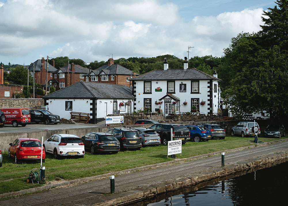
Telford Inn was called Scotch Hall when it was built in the late 1790s and is typical of Thomas Telford’s work as an architect, with a hipped roof and overhanging eaves. It was built for Matthew Davidson, the resident supervising engineer for the aqueduct. Davidson fell in love with Wales, and married a Welsh girl but he moved back to Scotland to work on the Caledonian Canal working with Telford again once the aqueduct was finished.
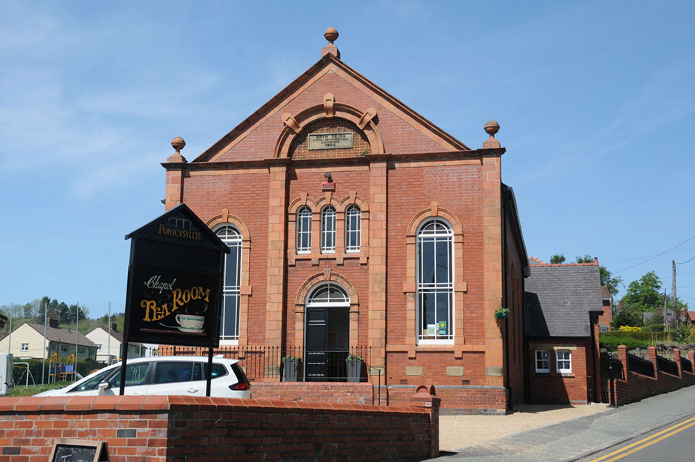
Bryn Seion Methodist Chapel was built in 1902 to replace an older chapel situated closer to the River Dee. The chapel closed in 1993 and was converted into an antiques shop. It was sold again and lovingly restored before opening as a tearoom in 2018.
© Jo Danson
© Jo Danson
Scotch Hall Bridge © Jo Danson
Telford Inn/Scotch Hall
Bryn Seion Chapel © Jo Danson
© Jo Danson
6. Froncysyllte – A Canalside Community
Froncysyllte flourished as the canal provided easy transport and opportunities for businesses to grow. At the heart of the village is the iconic lift bridge while just along the canal two banks of limekilns stand as reminders of former industry.
Froncysyllte, known locally as Fron, grew from a small rural hamlet with only about 15 houses and one inn to a hive of industrial activity after the canal opened. New houses, shops, church, chapels and a school were built while men left their work in the fields to work in the local limestone quarries and limekilns as well as the nearby coalmines and brickworks.
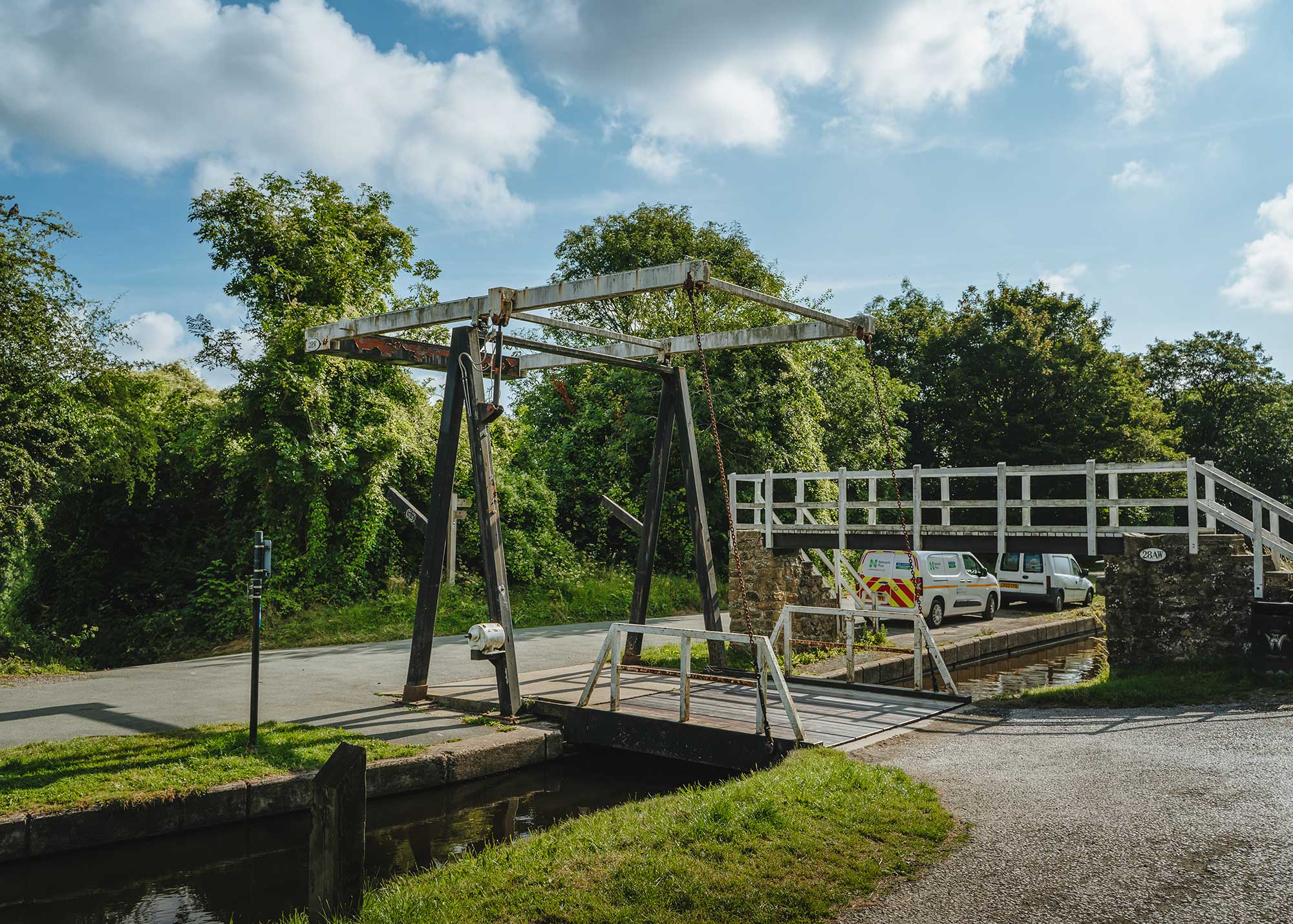
Fron Lift Bridge
Irish Bridge may have been named after the ‘navvies’, or ‘navigators’, who dug out numerous canal systems. Many of the navvies came from Ireland in search of work, as canal and road building thrived in the late 1700s and early 1800s. The arch of this bridge is much higher than others on the canal as this is such a deep cutting. Spoil from the cutting was used to create the embankment for Pontcysyllte Aqueduct.
Cross Street Aqueduct carries the canal over a farm track as it was easier to take the canal over the track than build a bridge to take the road over the canal. It was built using traditional stonework and puddled clay to make a watertight lining in the canal.
Small scale limestone quarrying had taken place in the Froncysyllte area since the 1500s, but the arrival of the canal provided cheap, efficient transport for limestone and lime products to reach new markets. Froncysyllte west limekilns were constructed in the early 1800s while the imposing Froncysyllte east limekilns with six arches towering above the canal were built in the late 1800s.
This iconic lift bridge was a more convenient way of allowing horses and carts to cross the canal than a conventional humpback bridge as it took up less space. The original timber bridge was operated by hand, pulling a chain to lift the deck.
Fron Basin marked the end of the Llangollen Canal until the Pontcysyllte Aqueduct was completed in 1805. Boats could turn in this area by putting the front of the vessel into the corner while the back of the boat was pulled around with a rope. Once the aqueduct was completed boats waited here to cross.
Fron Basin
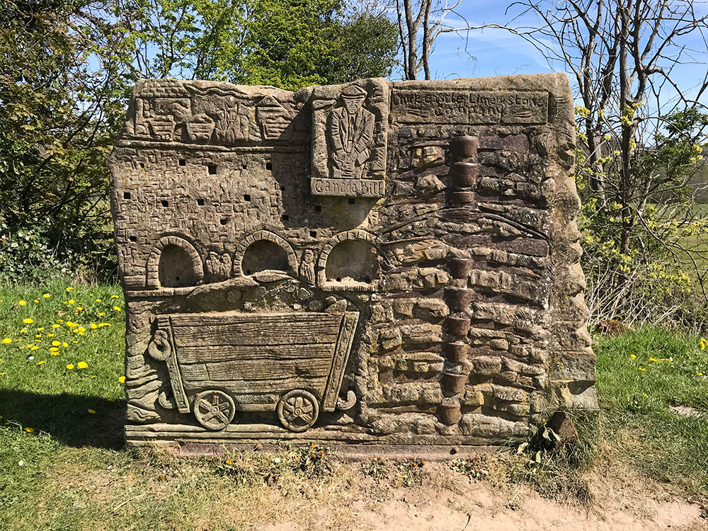
Lime Industry sculpture by Anthony Lysicea © Jo Danson
Irish Bridge
Cross Street Aqueduct
7. Chirk – A Border Town
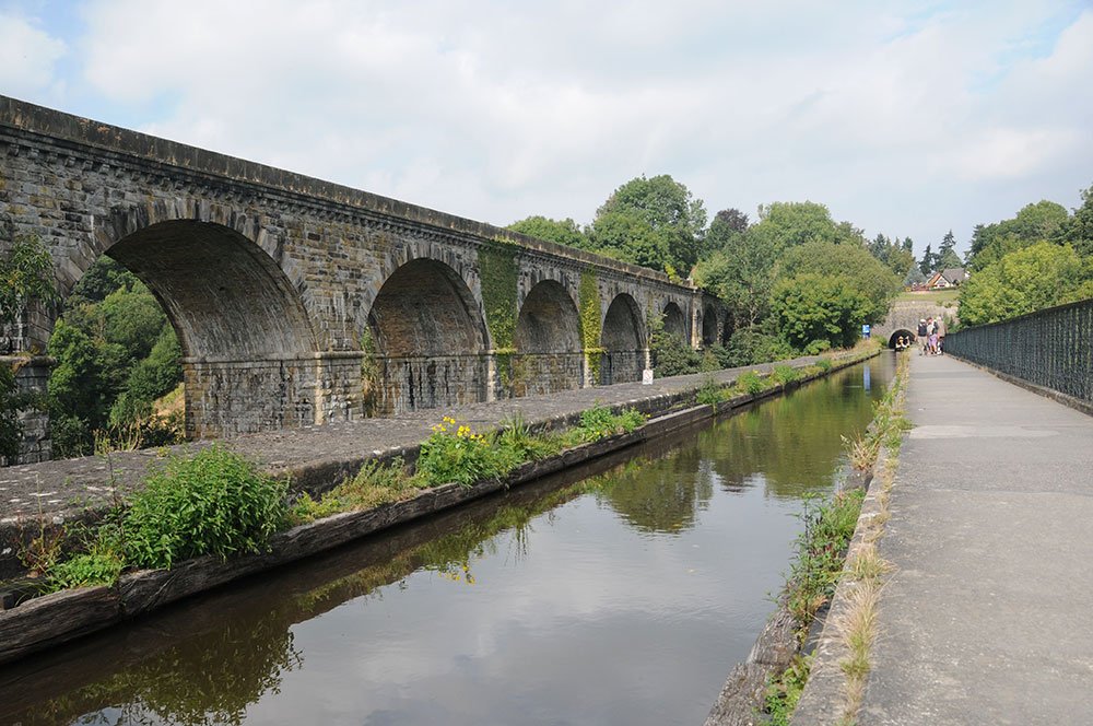
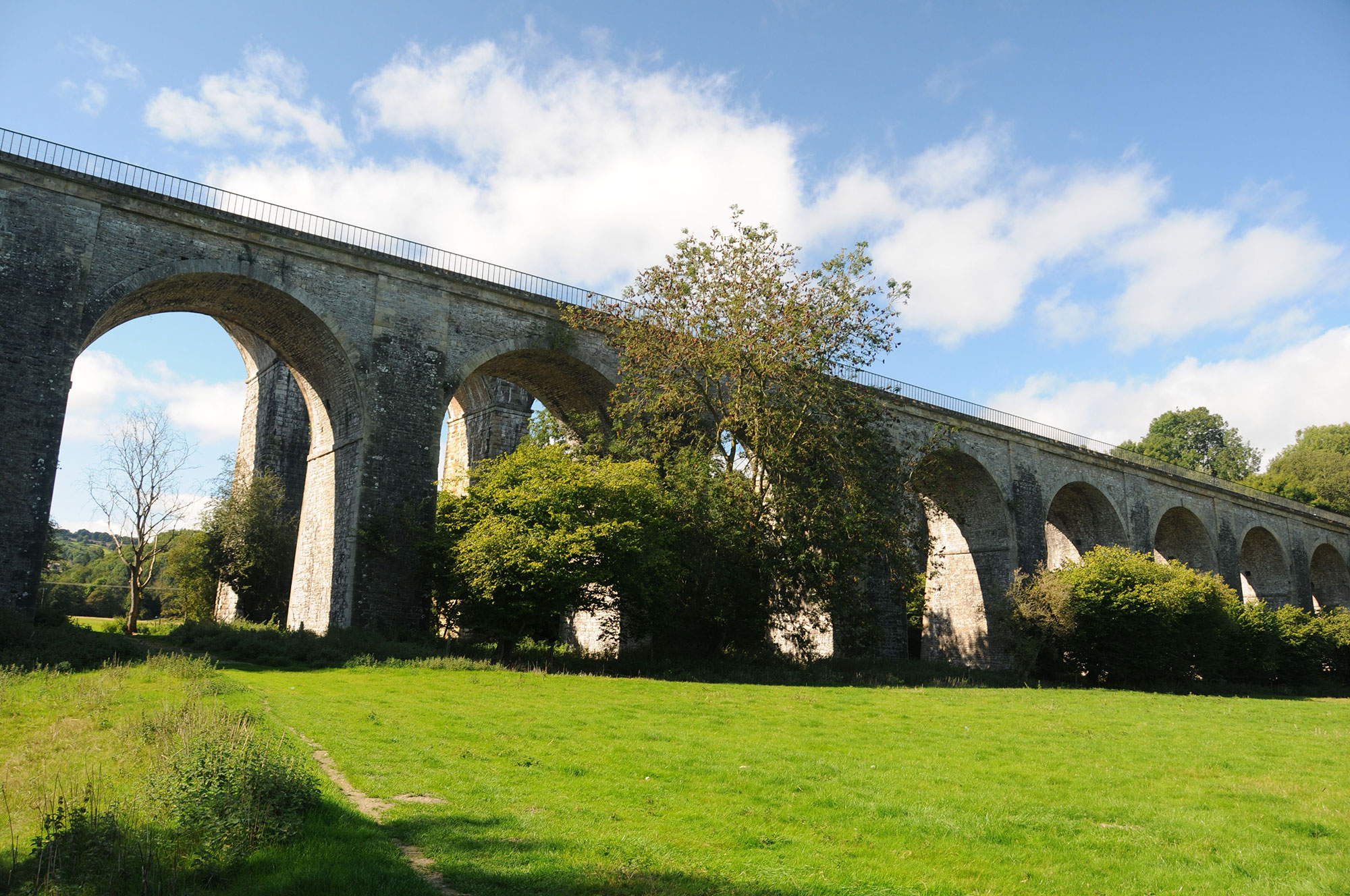
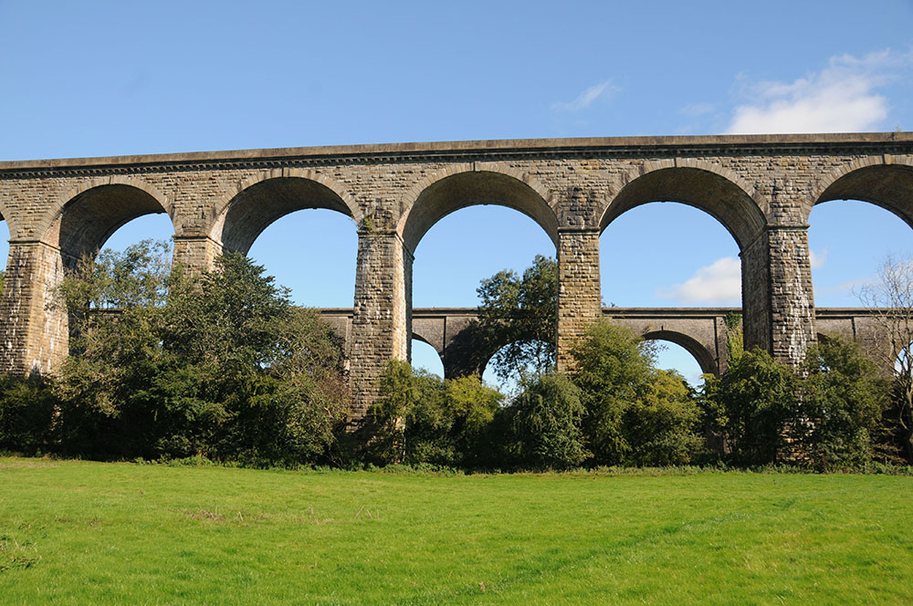
Chirk is rich in engineering features with an aqueduct, a viaduct and a tunnel clustered around the area that was once the public wharf for the town. The railway viaduct was built several years later than the aqueduct and provided fierce competition for trade on the canal but today they sit harmoniously in the landscape in matching warm sandstone.
The canal was a huge benefit to the industries in Ceiriog Valley when it reached Chirk in 1801. Slate, silica, coal and limestone were all quarried or mined in the Valley and the canal and later the railway provided access to wider markets.
Chirk Aqueduct © Jo Danson
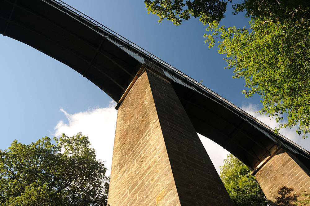
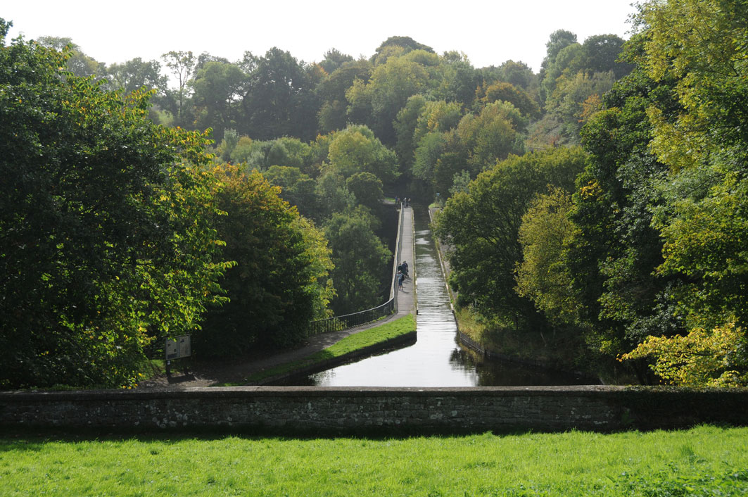
Chirk Aqueduct was the tallest navigable aqueduct in the world when it opened in 1801. New techniques were needed to build an aqueduct 220 metres/710 feet long and 21 metres/70 feet above the river. Ten hollow stone arches carry iron plates to form the bed of the canal. The sides of the trough were originally made waterproof with high-fired brick and mortar and faced with stone but iron side plates were installed in 1869.
Towering over the aqueduct is Chirk Viaduct, carrying the Ruabon to Chester railway over the River Ceiriog. Completed in 1848, it was this railway that would eventually play a part in the demise of the canal as a transport route for goods.
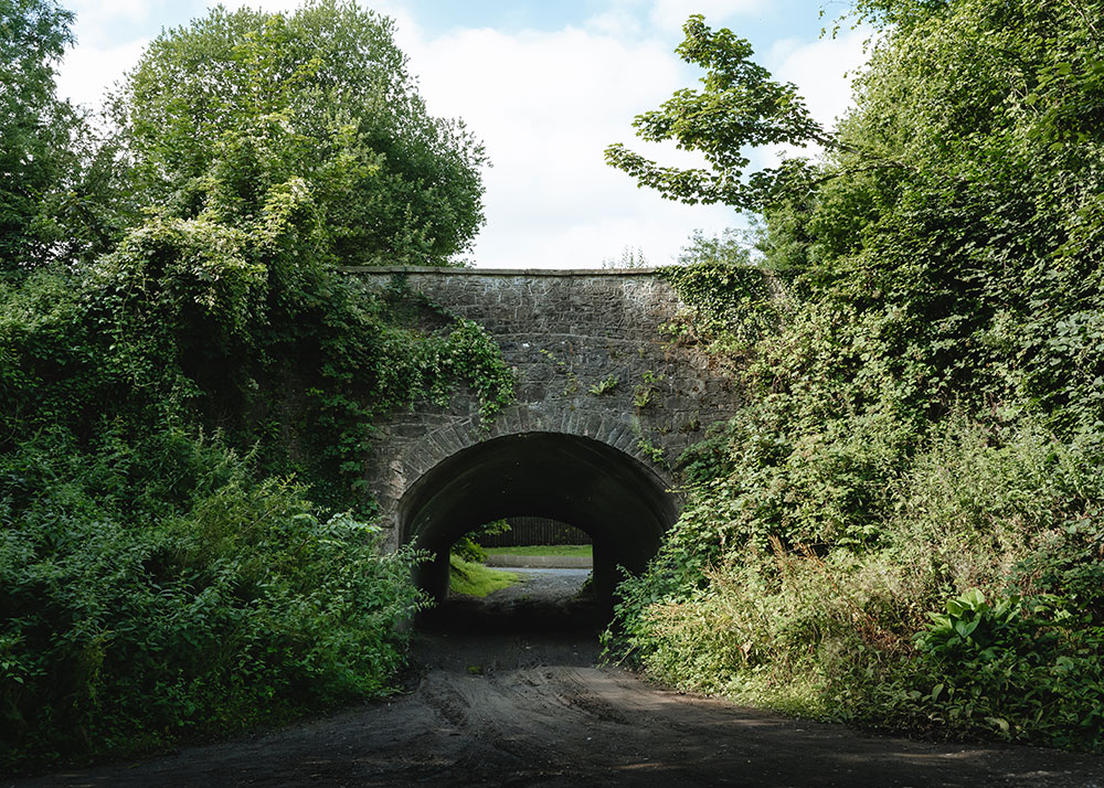
Chirk Tunnel was one of the first British canal tunnels to be built with a towpath. The tunnel is the longest on the canal at 421 metres or 460 yards and took seven years to build. The stone tunnel entrance is slightly flared making it easier for boats to enter while the fact it is straight means it is easier to see boats coming in the opposite direction.
© Jo Danson
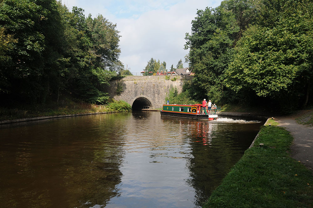
Chirk Tunnel © Jo Danson
Chirk Viaduct © Jo Danson
© Jo Danson
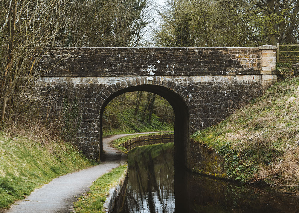
8. Gledrid Bridge – Gateway to the World Heritage Site
Gledrid Bridge marks the boundary of the World Heritage Site where the hilly terrain of Wales presented a challenge to the engineers who needed to work out how the canal could be built across deep river valleys.
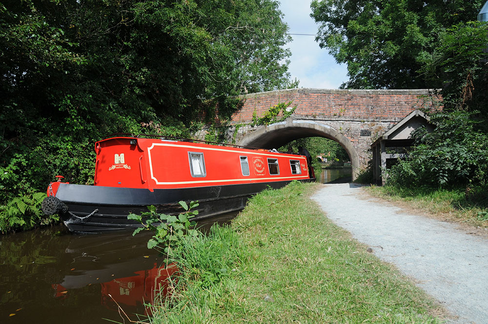
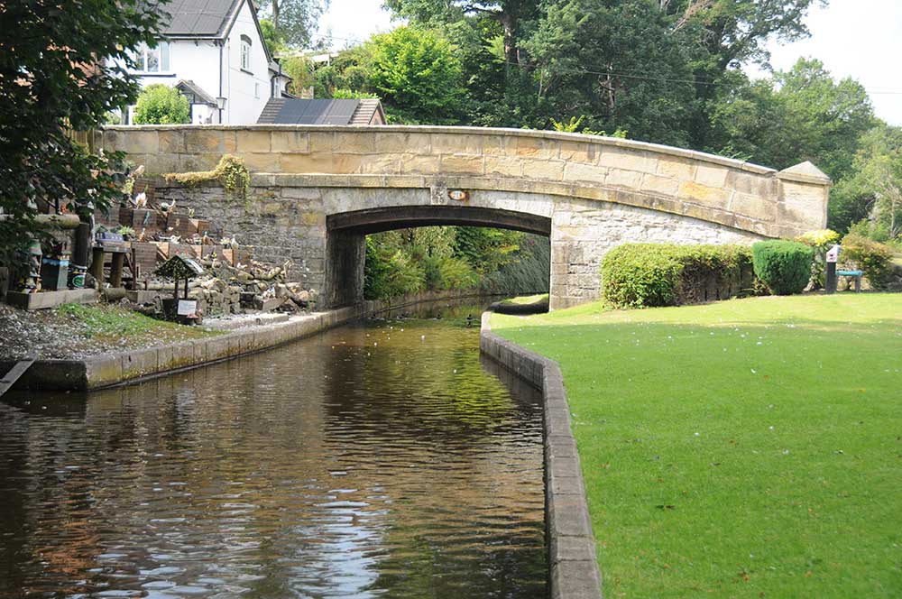
Gledrid Bridge was built in 1796 in the style typically used along the Ellesmere Canal. It is one of the few bridges over the Llangollen Canal that was built of brick rather than stone, as the canal was yet to reach the supplies of good building stone a little further on.
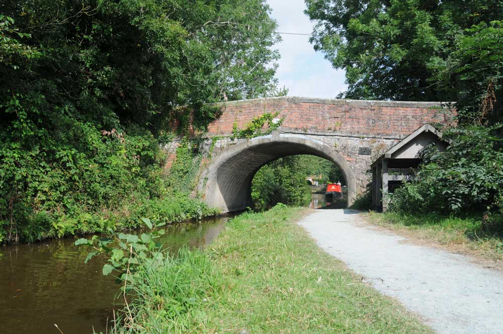
Gledrid Bridge © Jo Danson
The Poachers pub next to Gledrid Bridge has provided refreshments for generations of travellers. It was built between 1752 and 1838, almost certainly as the canal came into operation. The 1838 tithe map shows the site occupied by an inn with offices, a yard, garden and a malt house. It also provided stabling for horses, possibly used by some of the horses that pulled the canal boats.
The huge Chirk Bank embankment was made by cutting earth from the hillside above. It stretches almost three quarters of a mile from Chirk Bank Bridge to Chirk Aqueduct where the canal is carried across the Ceiriog Valley. The highest point of the embankment by the Aqueduct is 18.3m high and 60m across at its base.
Aqueduct Cottages were built by the Shropshire Union Railways and Canal Company at the end of the 1800s for canal maintenance workers and also possibly for men working on the Glyn Valley Tramway.
© Jo Danson
Chirk Bank Bridge © Jo Danson
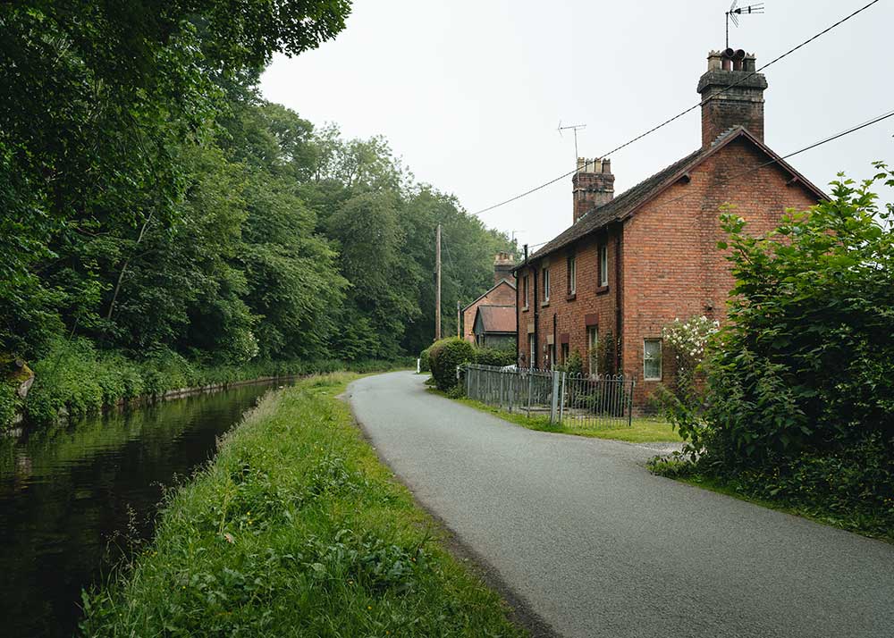
Aqueduct Cottages
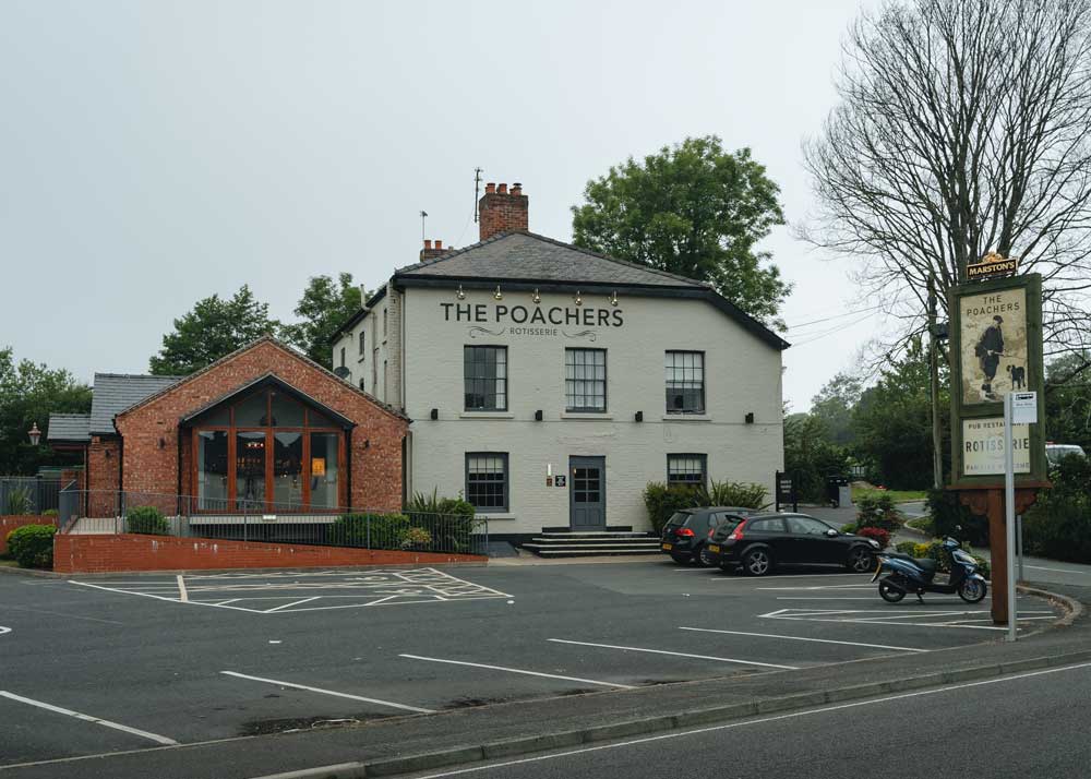
The Poachers